GIS Campus Reference Maps
GIS-Reporting@nau.edu | (928) 523-3335 | Quick links
GIS Services are offered to the NAU community in support of the student experience and campus operations. We maintain a spatial database of NAU assets, buildings, infrastructure, land-based information, points of interest, and imagery. We’re committed to supporting campus operations with thorough and accurate building information models (BIM), transportation networks, asset distribution data, grounds and maintenance maps and utility mapping support.
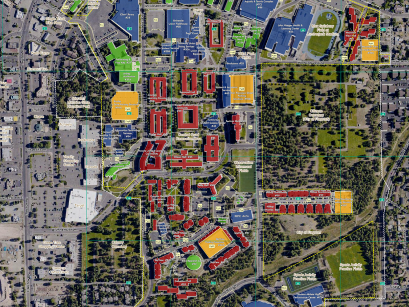
Aerial Reference Map
The Aerial Reference Map provides a satellite-hybrid view of the NAU Flagstaff Mountain Campus with color-coded labels for university boundaries, buildings, parking lots, and more.
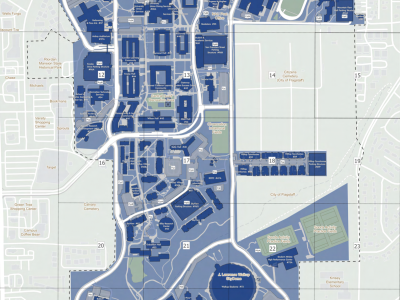
Boundary Basemap
The Boundary Basemap provides a color-coded boundary map of the NAU Flagstaff Mountain Campus, including property lines and sections.
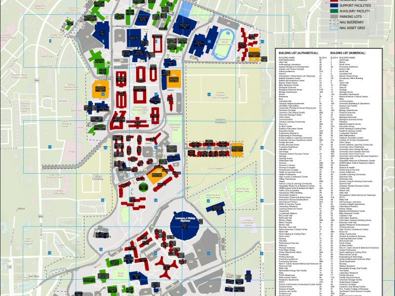
Building Reference Map
The Building Reference Map provides a color-coded view of all campus buildings with labels and a legend on the Flagstaff Mountain Campus for reference.