Projects
Web mapping projects
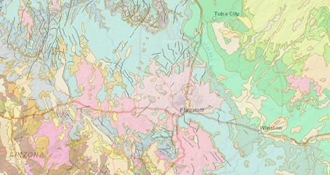
Arizona Online Atlas
The Arizona Online Atlas website is an interactive web-based map of Arizona that provides a wide array of map layers and tools for the user. Layers include geology, hydrology, point of interest, soils, and vegetation, and the tools include elevation profiles, routing, city gazetteer, parks and recreation gazetteer, a Weather Underground applet, and a draw and measure tool. This website was created using ArcGIS Server 10, Adobe Flex, ESRI Flex Viewer v2, and the ArcGIS Arizona Online Atlas Server for Flex API.
Flagstaff Recreation Atlas
The Flagstaff Recreation Atlas is an interactive web-based map that allows the user to map recreation-related geographic information, including roads, trail systems, and avalanche paths. In 2010, this information system was used to rapidly publish maps showing the perimeter and progression of the Schultz Fire. Fire perimeters are available for the Schultz, Eagle Rock and Hardy Fires. This project uses Adobe Flex, the ESRI Flex Viewer v1, and the ArcGIS Server for Flex API.
Other projects
Using HUD foreclosure data and GIS to visualize foreclosure risk in Google Earth
Using foreclosure data provided by the U.S. Department of Housing and Urban Development (HUD), the risk of foreclosure was mapped for every census block group in the United States. KML and KMZ files have been created to show foreclosure risk and can be downloaded here for each state in the country. These files can then be opened using Google Earth, popular and free online mapping software.
This project was a collaborative effort between the W.A. Franke College of Business and GRAIL.
Drought Impacts on Regional Ecosystems Network
The Drought Impacts on Regional Ecosystems Network (DIREnet) website is a portal to data, published research, news, and data related to the effects of drought and potential climate change on the Southwest’s forests and woodlands. This website was part of a larger DIREnet project that was designed to foster and facilitate research, bring scientists and land managers together to plan and conduct research, and promote the cross pollination of research and education through workshops, symposia, and student training.
Beaver Creek Environmental Atlas
The Beaver Creek Watershed is in the Central Arizona Highlands and superb example of a typical Southwestern hydrologic system. The Beaver Creek Environmental Atlas is an interdisciplinary educational resource that provides a wealth of information on various aspects of the Beaver Creek Watershed, including archeology, biology, climate, geology, conservation, and land use. This website also includes maps of the watershed’s geological features, soils, vegetation, and much more. The Beaver Creek Watershed Atlas provides educational resources and promotes research coordination and collaboration.