Northern Arizona hikes
Discover the perfect hiking trail near you! Experience the breathtaking beauty of Arizona’s abundant hiking trails. No matter where you’re located, there’s a hike waiting for you right in your area. Our hikes are conveniently organized by region, making it effortless for you to find a hike within your vicinity.


Flagstaff
Abineau to Bear Jaw Trail Loop
Distance: 6.9 miles on a loop
Elevation gain: 1,876 feet
Difficulty: 4
Heading up into the mountains, you’ll find snow and abundant wildlife. This is a challenging climb, but with much to see along the way. This hike is best in the summertime when you’re looking to escape the heat. Bring snow shoes if you plan to hike this trail before June (yes, there’s often 3+ feet of snow in May). We recommend you hike this loop counterclockwise and be prepared for an elevation change (right around 10K feet at the top).
Aspen Corner Loop Trail
Distance: 2.5 miles on a loop
Elevation gain: 656 feet
Difficulty: 3
Aspen and Pine trees and alpine meadows make up this beautiful trail. From this trail, you will see the volcanic field from the early formation of the San Francisco Peaks, as well as a view of the Grand Canyon (on a clear day). You’ll see countless birds and wildflowers, and other nature to appreciate along the way. Park in the lower lot of Snow Bowl to start this high-altitude hike.
Buffalo Park Trail
Distance: 2.2 miles on a loop
Elevation gain: 98 feet
Difficulty: 1
This trail is easy, has nice views, and is a simple way to get some fresh air without working too hard. Enjoy a relaxing stroll along well maintained paths. This trail is packed with runners and other hikers, so go early to beat the crowds.
Campbell Mesa Loop Trail
Distance: 5.5 miles on a loop
Elevation gain: 314 feet
Difficulty: 2
This is a great trail system with so many options to extend or shorten your hike. With little variation, this is great for beginners and is family-and pet-friendly. It’s a busy trail, but you’ll find more mountain bikers in this area than hikers. There is plenty of wildlife to enjoy too, so keep your eyes and ears open.
Fatman’s Loop
Distance: 2.4 miles on a loop
Elevation gain: 561 feet
Difficulty: 2
This is one of the most popular trails in Flagstaff, and for good reason. It’s short enough to finish and still have time for other activities. It’s challenging with some rocky climbs, and there are great views, plenty of shade, and options for side hikes or extensions. Bring your dog on a leash, and enjoy a nice morning adventure.
Humphreys Peak trail
Distance: 10.5 miles total out and back
Elevation gain: 3,353 feet
Difficulty: 5+
The tallest peak in all of Arizona, this trail is for our avid hikers with lots of experience and altitude training. The summit sits at 12,635 feet, so be prepared to have difficulty breathing up this absolute burner. It takes most hikers 6–8 hours, so pack lunch and lots of water. Do not get caught above the tree line in the afternoon. These peaks are known to generate their own weather, and a random storm could catch you in torrential rain, sleet, snow, hail, thunder, or lightning. Additionally, this peak is covered in snow most of the year. The best time for this hike is August and September when it’s free of snow.
Kachina Trail
Distance: 10.2 miles total out and back
Elevation gain: 1,528 feet
Difficulty: 4
This burner is a great challenge for intermediate/advanced hikers. During winter the trail is covered in snow and ice, so pack the snow shoes. Fall is the best time to attempt this hike, with the trees changing colors. In addition to abundant wildlife, you’ll enjoy a true wilderness experience with few other hikers.
Kendrick Peak Trail
Distance: 9.8 miles total out and back
Elevation gain: 2,693 feet
Difficulty: 5
Kendrick Peak is outside Flagstaff and is the highest peak in Arizona outside the San Francisco Peaks. This mountain is an absolute calf burner, with a steady incline up, and many switchbacks. The view at the top gives you a perfect line of sight to the San Francisco Peaks, the Grand Canyon, and all around. Bring lots of water for the trip and layers for the top. The hike is shady and the trail is mostly in the trees. Expect snow at the top from October–June.
Lava’s Edge Trail – Sunset Crater
Distance: 3.4 miles total out and back
Elevation gain: 173 feet
Difficulty: 2.5
Walk under ponderosa pines, explore loose cinders and rough basalt, and enjoy everything the Bonito Lava Flow has to offer. There is a fee to enter this area, but much to explore once you’re inside. Please stay on trails here; the environment is fragile.
Lockett Meadow Inner Basin trail
Distance: 3.4 miles on a loop
Elevation gain: 839 feet
Difficulty: 3
This busy hike is often crowded with other hikers, but the scenery is worthwhile. The aspens are beautiful in the fall, and the views from the inner basin area are breathtaking. Arrive at the parking area before 8:30 a.m. if you want to get a spot. Pack a camera and enjoy the views every step of the way. The road to this parking area is narrow, bumpy, and typically closed in winter due to snow.
Mount Elden Lookout Trail
Distance: 5.3 miles total out and back
Elevation gain: 2,312 feet
Difficulty: 5
Get ready for a stair master workout. This trail is steep, but the view from the top allows you to see out to the Mogollon Rim and as far as the Grand Canyon (on a clear day). It will be windy at the top, but the breeze will feel nice after the strenuous climb.
Old Caves Crater Trail
Distance: 4.2 miles on a loop
Elevation gain: 656 feet
Difficulty: 3
This trail is a step up for beginners and a fun day for more intermediate hikers. The climb up to the top is heart-pumping, but the trail is well-maintained and easy to follow. For your effort, you’ll be rewarded with a breathtaking view from the top. Coming back down, you’ll loop around on a flat section, but it’s shady and enjoyable. Bring your dogs or older kids and don’t forget to check out the caves.
Picture Canyon Trail
Distance: 2.8-3.93 miles on a loop
Elevation gain: 312 feet
Difficulty: 2
This trail is beginner-friendly and has options for how far to hike. The trail is well marked, but if you’re ever unsure which way to go, there’s cell phone service the entire hike, so pull up the website. The trail is a great option for hikers with families and pets. Enjoy the waterfall and petroglyphs, lots of shade, and cool history. It gets crowded, so we recommend going early and during the week.
Sandy’s Canyon Trail
Distance: 3.1 miles total out and back
Elevation gain: 305 feet
Difficulty: 2
This popular trail offers great views, and wide open spaces to breathe in the fresh air. The elevation gain is almost exclusively at the beginning/end when you drop into the canyon, and subsequently hike out at the end. Otherwise. it’s mellow and perfect for any hiker. Bring your dog and be sure to check out Fisher Point.
Sandy Seep Trail
Distance: 2.7 miles
Elevation gain: 370 feet
Difficulty: 1.5
This trail is relatively flat and takes you into a large field area with great views of the peaks. The best part is how easy it is to connect with other trails like the Little Elden Trail and the Christmas Tree Loop. With such little variation, anyone up for the extra mileage should consider adding these trails to make it a fun day exploring the woods.
Schultz Creek Trail
Distance: 8 miles total out and back
Elevation gain: 816 feet
Difficulty: 3
This shady trail is a nice moderate climb, but not technical at all. Enjoy a walk through the woods and check out the Flagstaff wildlife. There are many mountain bikers on this trail, so pay attention. The uphill is pretty steady, making the hike back enjoyable.
Sunset Trail
Distance: 8.3 miles total out and back
Elevation gain: 1,935 feet
Difficulty: 3.5
This trail has been a classic in the Flagstaff area for years. The top section was recently burned through by the Museum Fire, but it still has a lot of beauty and incredible views the whole way. The majority of the trail is a steady climb that is quite doable, but save some energy for the very end, where it gets much steeper to climb to the top. Enjoy the views of Flagstaff and the Painted Desert.
Walnut Canyon Hike (In Walnut Canyon National Monument)
Distance: 1 mile round trip
Elevation gain: 185 feet
Difficulty: 1
This trail is within the national monument, which requires a fee to enter. But once you’re in, enjoy all the information provided in the visitor center, as well as this incredible cultural hike around well-preserved Indigenous dwellings.
Camp Verde
Chasm Creek Trail
Distance: 12.4 miles total out and back
Elevation gain: 3,228 feet
Difficulty rating: 5
This trail is for the advanced hikers looking for a challenge. Get ready to get your heart pumping and legs burning with this hard-hitting trail. Pack snacks and lots of water for a full day of hiking. Enjoy the views and wildlife on this seldom-used trail.
Copper Canyon Loop
Distance: 3.9 miles on a loop trail
Elevation gain: 387 feet
Difficulty rating: 3
This hike is a great way to get out and about while enjoying the great views it has to offer. Whether it be trail running, walking the dogs, or a solo hike, this quiet trail is a great way to enjoy a beautiful morning or evening. In summer, the hike can get very hot.
Fossil Creek Waterfall Trail
Distance: 2.6 miles total out and back
Elevation gain: 249 feet
Difficulty rating: 3
The Fossil Creek Trail is a gorgeous trail leading down to a waterfall that provides a great spot for a picnic, swimming in the creek, and relaxing by the falls. Hikers can bring dogs as long as they are on a leash.
Indian Maiden Falls
Distance: 9.2 miles total out & back
Elevation gain: 2,250 feet
Difficulty rating: 5
This is no hike for the faint of heart! Gorgeous waterfalls, rivers, and views capture your eyes as you make a technical, sun-exposed descent into West Clear Creek. The trail descending into the canyon can be slippery due to the loose rock.
Montezuma Castle National Monument
Distance: .4 miles on a loop trail
Elevation gain: 22 feet
Difficulty rating: 1
Accessible all year around allows one to gaze in awe at the cliff dwellings that were once called home to the Indigenous People who lived there. Dogs are welcome on this trail but must be kept on a leash.
McDonald Trail
Distance: .9 miles total out and back
Elevation gain: 334 feet
Difficulty rating: 1
Near Camp Verde, this hike allows hikers to scramble around a set of caves, which may pose a challenge for some as there is loose rock scattered around.
Rockin River Ranch State Park
Distance: 1.7 miles on an out-and-back
Elevation gain: 52 feet
Difficulty rating: 1
Great for all skill levels, this hike also allows for the chance to see wildlife. Low mileage, hardly any variation, you can take your time and take in all mother nature has to offer on this lovely stroll.
Verde Rim Loop Trail
Distance: 14.3 miles on a loop trail
Elevation gain: 2,808 feet
Difficulty rating: 5
This trail is difficult, lightly trafficked, and worth the effort. The views throughout the hike are outstanding, and the beautiful flowers will make you appreciate it even more. Bring dogs to experience this beautiful and serene hike but remember, like most hikes, dogs must be on a leash.
White Bridge to Beasley
Distance: 9.3 miles on a point-to-point trail
Elevation gain: 117 feet
Difficulty rating: 2
This is a great scenic view for hikers. The trail is long, easy, and great for all levels. As a bonus, it’s accessible all year.
Holbrook
Agate House Trail
Distance: 1.9 miles on an out-and-back trail (total distance–3.8 miles)
Elevation gain: 65 feet
Difficulty rating: 2
This trail offers hikers the opportunity to see wildflowers. Dogs are allowed on the trail but must be on a leash.
Blue Mesa Trail
Distance: 0.9 miles on a loop trail
Elevation gain: 108 feet
Difficulty rating: 1
This hike is accessible year-round. Dogs are allowed but must be on a leash. The trail is short, but worth checking out the beauty, especially in spring.
First Forest Point
Distance: 4.4 miles on an out-and-back trail (total distance–8.8 miles)
Elevation gain: 288 feet
Difficulty rating: 3
This hike is accessible year-round. Dogs are allowed on the trail but must be kept on a leash. The trail does not offer shade, so please bring ample amounts of water and sun protection.
Giant Logs Trail
Distance: 0.6 miles on a loop trail
Elevation gain: 33 feet
Difficulty rating: 1
This hike is accessible year-round. Dogs are allowed on the trail but must be kept on a leash. It offers wide-open views on a short loop for hikers to check out the natural beauty.
Kingman
Bull Mountain
Distance: 4 miles on an out-and-back trail (total distance 8 miles)
Elevation gain: 1,230 feet
Difficulty rating: 3
Some parts can be steep and tricky, so having the right shoes is essential. Parts of the trail get steep but eventually level out. No dogs are allowed on this hike.
Camp Beale Loop
Distance: 3.2 miles on a loop trail
Elevation gain: 580 feet
Difficulty rating: 2
This trail gives hikers the chance to see wildlife and is accessible all year round. Dogs are allowed but must be kept on a leash.
Cherum Peak Trail
Distance: 5.6 miles out-and-back trial (Total distance 11.2 miles)• Elevation gained: 1282• Difficulty rating: 3o Easy to follow and has nice views at the end. This trail can require some careful maneuvering if snow or ice are on it. Dogs are allowed on this trail but must be kept on leash.
Hayden Peak Summit Trail
Distance: 5.5 miles out-and-back trail (total distance–11 miles)
Elevation gain: 1,758 feet
Difficulty rating: 4
During certain months of the year, the trail can have snow and ice on it. Once hikers reach the top, they are rewarded with beautiful views. Dogs are not allowed on this trail.
Hualapai Mountain via Potato Patch
Distance: 5 miles on a loop trail
Elevation gain: 1,097 feet
Difficulty rating: 3
This is a great leg burner for intermediate-level hikers. Getting to the top of this hike is worth the challenging climb. You can pick up a map at the ranger station at the base of this hike. The trail rewards hikers with stunning views and allows dogs as long as they are kept on a leash. Bring sun protection and plenty of water.
Little Hualapai Trail
Distance: 3.4 miles on an out-and-back trial (total distance 6.8 miles)
Elevation gain: 666 feet
Difficulty rating: 2
This is a great beginner trail for people to explore and get out more. The best times for this hike are September–June; hikers will enjoy the wildflowers and great views along the way. No dogs are allowed on the trail.
Monolith Garden Trail
Distance: 7 miles on a loop trail
Elevation gain: 557 feet
Difficulty rating: 2
Even though this hike is a little further than other two-rated hikes, it is friendly for all levels. The hike offers views of wildflowers and is best during winter months in Arizona. Dogs are allowed on this hike but must be kept on a leash.
White Cliffs Wagon Trail
Distance: 2.4 miles on an out-and-back trail (total distance–4.8 miles)
Elevation gain: 324 feet
Difficulty rating:2
This hike is best from September–April when temperatures are cooler. Dogs are not allowed. The 4×4 trail has so much to offer and is great for any level hiker. We recommend checking this one out on a cloudy day.
Page
Antelope Canyon
Distance: 0.6 miles on a loop trail
Elevation gain: 91 feet
Difficulty rating: 1
This is another geological location that offers a wow factor. To access Antelope Canyon, there is a $40–$68 tour fee.
Hanging Garden Trail
Distance: 1.2 miles on an out-and-back trail (total distance–2.4 miles)
Elevation gain 62 feet
Difficulty rating: 1
Accessible all year around, the trail features a lake and is a welcoming introduction to hikers of all levels. Dogs are allowed on this trail while on a leash. We highly recommend checking out the flora/fauna on this pleasant walk.
Horseshoe Bend Trail
Distance: 1.5 miles on an out-and-back trail (total distance–3 miles)
Elevation gain: 242 feet
Difficulty scale: 1
An amazing geologic location offers hikers the chance to gaze upon a gorgeous view. This is a very heavily trafficked place but will not disappoint. Dogs are allowed on this trail as long as they are on a leash. It is accessible year-round.
Lees Ferry/Spencer Trail Lookout
Distance: 3.8 miles on an out-and-back trail (total distance–7.6 miles)
Elevation gain 1,614 feet
Difficulty rating: 3
Along this trail, hikers will find rusting equipment, ruins, and a shipwreck as they reach the Grand Canyon. Dogs are allowed on this trail but must be kept on leash.
Lonely Dell Ranch Historic Site
Distance: 0.7 miles on an out-and-back trail (total distance–1.4 miles)
Elevation gain: 6 feet
Difficulty rating: 1
This historical site offers an immense amount of history to those who choose to hike it. Dogs are allowed on the trail but must be kept on a leash.
Nine Mile Draw Trail
Distance: 4.7 miles on an out-and-back trail (total distance–9.4 miles)
Elevation gain: 682 feet
Difficulty rating: 2
Once you get further away from the crowds at Horseshoe Bend, this will be an amazing hike. The ending location is one you won’t forget.
Page Mesa Trail
Distance 13.1 miles on a loop trail
Elevation gain: 688 feet
Difficulty rating 3
For beginning hikers looking for the chance to start pushing themselves, this is a great hike to choose from. It boasts amazing scenery combined with beautiful flowers. Dogs are allowed on this trail.
Paria Canyon
Distance: 5.6 miles on an out-and-back trail (total distance–11.2 miles)
Elevation gain: 249 feet
Difficulty rating: 2
This trail is best used during the warmer months of April–October. This trail is used for hiking, camping, and trips to enjoy nature. Dogs are allowed on the trail.
Rock Lane Trail
Distance: 1.9 miles on a loop trail
Elevation gain: 209 feet
Difficulty rating: 1
Great for hikers of all skill levels, this trail offers an easy-going workout after a long day. Dogs are not allowed on the trail. The short loop has some good views, but lots of sunshine too, so bring sun protection and plenty of water.
Waterhole Canyon Trail
Distance: 2.8 miles on an out-and-back trail (total distance–5.6 miles)
Elevation gain: 305 feet
Difficulty rating: 1
Inside a canyon, hikers will find an easy trek that features a river. This area is only accessible by tour companies.
Prescott
Antelope Canyon
Distance: 0.6 miles on a loop trail
Elevation gain: 91 feet
Difficulty rating: 1
This is another geological location that offers a wow factor. To access Antelope Canyon, there is a $40–$68 tour fee.
Hanging Garden Trail
Distance: 1.2 miles on an out-and-back trail (total distance–2.4 miles)
Elevation gain 62 feet
Difficulty rating: 1
Accessible all year around, the trail features a lake and is a welcoming introduction to hikers of all levels. Dogs are allowed on this trail while on a leash. We highly recommend checking out the flora/fauna on this pleasant walk.
Horseshoe Bend Trail
Distance: 1.5 miles on an out-and-back trail (total distance–3 miles)
Elevation gain: 242 feet
Difficulty scale: 1
An amazing geologic location offers hikers the chance to gaze upon a gorgeous view. This is a very heavily trafficked place but will not disappoint. Dogs are allowed on this trail as long as they are on a leash. It is accessible year-round.
Lees Ferry/Spencer Trail Lookout
Distance: 3.8 miles on an out-and-back trail (total distance–7.6 miles)
Elevation gain 1,614 feet
Difficulty rating: 3
Along this trail, hikers will find rusting equipment, ruins, and a shipwreck as they reach the Grand Canyon. Dogs are allowed on this trail but must be kept on leash.
Aspen Creek Trail
Distance: 11.5 miles total out and back
Elevation gain: 1,912 feet
Difficulty rating: 4
Get ready for a fun challenge with this trail to summit Thumb Butte. The elevation gain is mostly gradual. There have been many sightings of Bald Eagles and other wildlife. Pack lots of water for a long day on the trail. It starts shaded by trees but gets more exposed the higher you go, so bring sun protection and your camera for the views.
Constellation Loop Trail
Distance: 2.4 miles on a loop
Elevation gain: 236 feet
Difficulty rating: 1
This trail is well-marked and has tons of interesting features. The rock formations are unlike any other trail in the area, but the path is easy to navigate and great for younger kids and pets too.
Gold Water Lakes Trail
Distance: 8.1 miles total out and back
Elevation gain: 1,233 feet
Difficulty rating: 3.5
Don’t let the distance scare you off. This hike has gradual climbs and benches along the lake for breaks and beautiful views. The trail can get muddy after snow or rain, but that only adds to the adventure.
Granite Mountain Trail
Distance: 8.1 miles total out and back
Elevation gain: 1656 feet
Difficulty rating: 3.5
This trail features a nice creek along the way (mostly in spring). It gets a little more challenging closer to the top, but the view is worth the climb. Go earlier to beat the heat and the crowds, and you will see wildlife along the way.
Little Granite Trail
Distance: 9.6 miles on a loop
Elevation gain: 1,811 feet
Difficulty rating: 4
One of the top-rated trails in the Prescott area, it’s a challenging must-do. There’s plenty of change in scenery, and you’ll feel like a champion after completing this rewarding hike. Wear your best boots and pack lots of water.
Lynx Lake Loop Trail
Distance: 2.4 miles
Elevation gain: 78 feet
Difficulty rating: 1
This loop goes around one of the most beautiful lakes in Prescott, and it’s partially paved and accessible to all people. The variety of birds along this hike is impressive, so keep your eyes and ears open, and enjoy the colorful plumage these creatures offer.
Peavine Trail
Distance: 12 miles total out and back
Elevation gain: 462 feet
Difficulty rating: 4
This trail is a great intro to longer hikes. There is very little variation in elevation, but you have the option to go the full 6 miles out one way, making it a long 12-mile round trip. It’s exposed to the sun, so bring the sunscreen. This area charges a $3 parking fee to access the trailhead.
Prescott Circle Trail
Distance: 54 miles on a loop
Elevation gain: 6,289 feet
Difficulty rating: 5
This backpacking or mountain biking trail is meant for the hiking experts out there. This loop system was put together as a collaborative effort from multiple land agencies and the city of Prescott. You will get views of multiple lakes, cut through the Granite Dells, and enjoy the sites of Granite Mountain and Thumb Butte.
Spruce Mountain via Groom Creek Loop
Distance: 9.8 miles on a loop
Elevation gain: 1,637 feet
Difficulty rating: 4
This loop is a great challenge for intermediate hikers. The wildflowers are a must-see, so bring your dog (on a leash) and enjoy this forested adventure. The view is fantastic at the top and worth the climb. It’s a bit rocky in parts, so wear good shoes with ankle support.
Thumb Butte Trail
Distance: 2.5 miles on a loop
Elevation gain: 688 feet
Difficulty rating: 2
This well-marked trail is perfect for any hiker looking for a moderate adventure. Start the loop to the right for a more gradual climb, or go left for a steeper challenge. There is a $5 fee to access this area.
Watson Lake and Flume Trail
Distance: 4.5 miles on a loop
Elevation gain: 367 feet
Difficulty rating: 2
This loop is one of the most popular hikes in Prescott, and for good reason. With beautiful lakeside views, abundant wildlife, and easy access, you can enjoy this hike year-round.
White Spar Loop Trail
Distance: 2.4 miles on a loop
Elevation gain: 265 feet
Difficulty rating: 1
This is a great hike for beginners or anyone looking for an easy trail. Some parts have shade while others are cleared from logging. There’s plenty of wildlife, and beautiful plants and trees to enjoy along the way.
Willow Lake Trail
Distance: 5.7 miles on a loop
Elevation gain: 354 feet
Difficulty rating: 3
This trail offers a lot of variety. It’s not much in the way of climbs but includes some rocky areas. There are some grassy parts, lots of sun and shade too. If the lake water is high, part of the trail may be submerged and impassible. Spring brings the bugs, so bring bug spray and enjoy the views. The trail isn’t well marked, so get a map to help you navigate it.
Wolf Creek Loop Trail
Distance: 5.5 miles on a loop
Elevation gain: 810 feet
Difficulty rating: 3
This hike has spots with incredible views and beautiful scenery. The trail follows a 4×4 road and has some rocky spots to be aware of. There’s creek access and lots of shade, so enjoy this one on a hot summer day. Don’t forget to check out the small waterfall; it’s a must-see.
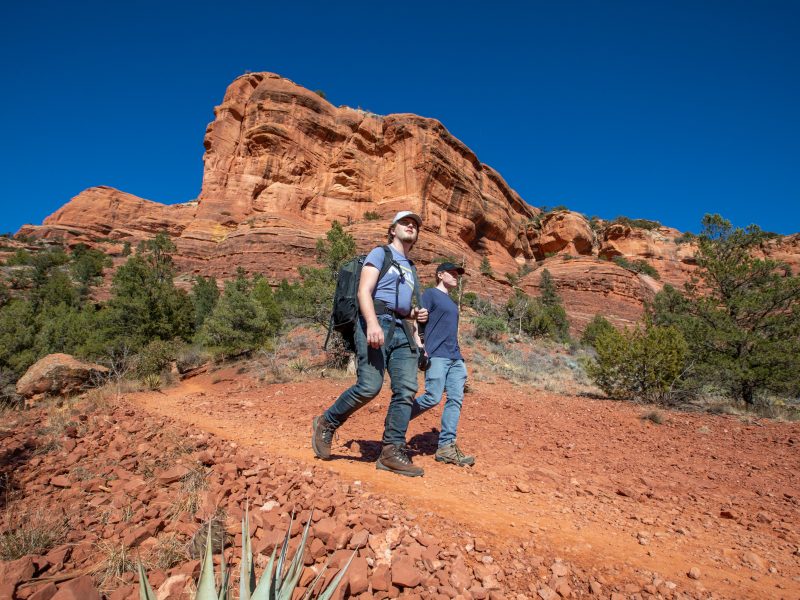
Sedona area
Airport Mesa Loop Trail
Distance: 3.2 miles on a loop trail
Elevation gain: 416 feet
Difficulty rating: 2
The end of this trail will offer plenty of great views for all who attempt it. Dogs are allowed on this trail but must be on leash. This loop is the perfect morning hike in Sedona for any level.
Bear Mountain Trail
Distance: 4.9 miles total out and back
Elevation gain: 1,975 feet
Difficulty rating 3
This hike features a river to cool off as hikers make their trek to the top. The views at the top won’t disappoint. Leashed dogs are allowed on this trail. Don’t be fooled by the moderate distance; this is a burner and provides a great challenge for most hikers. Come prepared with snacks, water, and sun protection.
Bell Rock Trail
Distance: 3.6 miles total out and back
Elevation gain: 318 feet
Difficulty rating: 1
a great trail for all levels of hikers looking to get out and explore. The trail is dog-friendly and perfect for families looking to get out for a nice hike.
Boynton Canyon Trail
Distance: 6.2 miles total out and back
Elevation gain: 810 feet
Difficulty rating: 3
This trail is a nice, longer day hike and gives hikers the chance to see wildlife along the way. Dogs are allowed on the trail.
Brins Mesa Trail
Distance: 4.5 miles total out and back
Elevation gain: 870 feet
Difficulty rating: 2
Scenic views await hikers at the top of this great trail that is amazing for hikers of all levels. Dogs are allowed on this trail but must be kept on a leash.
Broken Arrow Trail
Distance: 3.2 miles on a loop trail
Elevation gain: 413 feet
Difficulty rating: 2
This is the perfect hike for intermediate hikers to enjoy a nice loop with classic Sedona views. Dogs are allowed on leash. Keep an eye out for mountain bikers, but enjoy the abundant wildlife, especially the flowers in spring.
Cathedral Rock Trail
Distance: 1.2 miles total out and back trail
Elevation gain: 751 feet
Difficulty rating: 1
The trail leading to Cathedral Rock will not disappoint and is great for any level of hiker. Dogs are allowed but must be on a leash.
Courthouse Butte Loop
Distance: 3.9 miles on a loop trail
Elevation gain: 357 feet
Difficulty rating:2
This is a great trail located in Sedona that is perfect for any level of hiker. Wildlife can be seen on this hike and dogs are allowed as long as they are leashed.
Devil’s Bridge
Distance: 4.2 miles total out and back
Elevation gain: 564 feet
Difficulty rating:2
Devils Bridge is a must-see while in the Sedona area. This is a great hike for all levels of hikers and offers amazing views and flowers. Dogs are allowed on this trail but must be kept on a leash. This is one of the more popular hikes, so start early. We recommend sturdy hiking shoes, water, and sun protection.
Doe Mountain Trail
Distance: 1.5 miles on a loop trail
Elevation gain: 492 feet
Difficulty rating: 1
This is another great hike in Sedona that welcomes anyone who wants to get out. The trail is known for its wildflowers and views. Dogs are allowed but must be kept on a leash.
Fay Canyon Trail
Distance: 2.6 miles total out and back
Elevation gain: 383 feet
Difficulty rating: 2
Hikers who take this trail will love what is at the end. Accessible all year, dogs are allowed on this trail. With little variation in difficulty, all hikers will love the beautiful Sedona views.
Honanki Heritage Site
Distance: 0.6 miles total out and back trail
Elevation gain: 354 feet
Difficulty rating:1
The end of this hike offers hikers a glimpse into the past with cliff dwellings. Dogs are not allowed on this trail.
Margs Draw Trail
Distance: 4.0 miles total out and back
Elevation gain: 393 feet
Difficulty rating:2
Accessible all year around, this a great hike for everyone and offers great views at the top. Dogs are allowed on the hike but must kept be on a leash.
Secret Canyon
Distance:14.7 miles on a point-to-point trail
Elevation gain: 1,627 feet
Difficulty rating: 3
Since this hike is on a point-to-point trail, hikers must have a car waiting for them at the other end. This trail is scenic because of the waterfalls that can be seen along the way. It is best November–April.
Soldiers Pass Trail
Distance: 4.1 miles total out and back
Elevation gain: 620 feet
Difficulty rating: 2
Another trail that is great for all levels of hikers in the Sedona area. The amazing views will be waiting for you at the top. Dogs are allowed on this trail but must be kept on a leash.
Show Low/Pinetop
Buena Vista Trail
Distance: 10 miles on a loop (with options to make it shorter)
Elevation gain: 1,220 feet
Difficulty rating: 3
This lovely walk in the woods is well-shaded and features plenty of wildlife, including wild horses (on the right day). There is a mix of single-track hiking and walking along a 4×4 road. There are options to make this hike a little shorter with cross trails.
Fool Hollow Lake Trail
Distance: 3.2 miles total, out and back
Elevation gain: 72 feet
Difficulty rating: 2
Perfect for beginners, hikers should walk along the lake for maximum wildlife viewing. There is a $10 fee to get into the park, so pack a lunch and enjoy the whole day by the lake.
Los Caballos Trail
Distance: 14.6 miles on a loop
Elevation gain: 1,213 feet
Difficulty rating: 4
If it weren’t for the distance, this trail would be much more moderate. Wear sturdy shoes and pack plenty of water and snacks for this adventure. There is plenty of wildlife to view and a lot of direct sunlight, so bring the sunscreen. Most of this loop is on 4×4 trails; it can get muddy after a snow melt or rain storm.
Los Burros Trail
Distance: 13 miles on a loop
Elevation gain: 1,253 feet
Difficulty rating: 4
This trail is for experienced hikers looking for a fun challenge with beautiful scenery. The hike features incredible wildflowers, plenty of shade, and lots of wildlife. The trail is open any time of year. Dogs are welcome but must be kept on a leash.
Mogollon Rim Interpretive Trail
Distance: 1 mile on a loop
Elevation gain: 59 feetDifficulty rating: 1o Notes: This heavily visited trail has so much to see and learn about in a short distance. It’s incredibly easy to access and has some incredible panoramic views, especially at sunset. With roughly 17 interpretive stops, there’s a lot packed into this short adventure.
Show Low Bluff Trail
Distance: 1.1 miles out and back
Elevation gain: 16 feet
Difficulty rating: 1
This is a great short trail to kick off your morning or a perfect stroll to enjoy with a small dog or toddler. There’s a nearby creek for a little off-trail adventure and a disc golf course along the way to add to the outing.
Timber Mesa Trail
Distance: 7.2 miles on a loop
Elevation gain: 587 feet
Difficulty rating: 3
Enjoy this relaxing nature walk through mixed vegetation. There is little variation in difficulty, so don’t let the distance scare you away. Bring your dog (on a leash) and enjoy the scenic views this mesa has to offer.
Woodland Lake Outer Loop Trail
Distance: 3.8 miles on a loop (with options to make it shorter)
Elevation gain: 223 feet
Difficulty rating: 1
This trail is great for an easy lakeside stroll or a fun day checking out the wildlife with young kids. About 1 mile is paved along the water, so it’s easily accessible to everyone looking for fresh air and shady spots to relax.
Williams
Benham Trail
Distance: 5.8 miles
Elevation gain: 1,456 feet
Difficulty rating: 3
This hike is accessible year-round. Dogs are welcome but must be leashed. No water is available in the area, but cool temperatures make for a nice summer hike or bike.
Bill Williams Mountain Trail
Distance: 7.3 miles
Elevation gain: 2,345 feet
Difficulty rating: 5
No water is available along the trail. This hike includes a great forest scene and is open for horse riding, hiking, and mountain biking. Dogs must be leashed. The trail is Easier to hike in the summer when the snow and ice have melted. Don’t be fooled though! It’s a tough, steep climb that will make hikers work hard for the view at the top.
Clover Spring Trail
Distance: 2.3 miles
Elevation gain: 488 feet
Difficulty rating: 2
This trail is located on the lower slopes of Bill Williams Mountain. Clover Spring is a small seep that was once developed as a domestic water supply and now provides water to wildlife. Water from this spring may not be safe for human consumption. The trail is most commonly used for hiking and trail running.
Davenport Hill Trail
Distance: 5.1 miles
Elevation Gain: 823 feet
Difficulty Rating: 3
This is a summit hike with beautiful views. There is a nice forest scene with changing trees as you move up in elevation. It is best experienced March–September. Dogs must be leashed.
Dogtown Lake Trail
Distance: 2.5 miles loop
Elevation gain: 62 feet
Difficulty rating: 1
This hike features a beautiful lake. Dogs are allowed but must be leashed. The trail is perfect for beginner hikers or anyone seeking a relaxing walk.
Dude Mountain
Distance: 1.3 miles
Elevation gain: 370 feet
Difficulty rating: 3
Primarily used for hiking and trail running this is a nice trail to attempt when staying at the nearby campground. The trail is semi-steep with some loose rocks that end with a beautiful view.
Gasline Loop
Distance: 1.7 miles loop
Elevation gain: 187 feet
Difficulty rating: 1
Enjoy a relatively flat walk through the woods with the perfect balance of shade and sun. Best from April–September, this hike boasts beautiful wildflowers and lots of shade, but be sure to bring water. Be mindful of your footing on loose rocks.
Keyhole Sink
Distance: 1.3 miles
Elevation gain: 95 feet
Difficulty rating: 1
This trail provides the visitor with an easy hike to a scenic box canyon where prehistoric residents left petroglyphs carved into the canyon’s gray volcanic walls. Best experienced March–November, the hike features a waterfall. Dogs must be leashed.
Summit Mountain Trail
Distance: 2.5 miles
Elevation gain: 652 feet
Difficulty rating: 3
The well-defined trail climbs steadily up 650 feet over its mile length through a forest of ponderosa pine, Gambel oak, and alligator juniper. It is best experienced from September–April and is known for its beautiful wildflowers. From the end of the trail, you will find an excellent vista of the forest and rim country as it falls off to the headwaters of the Verde River and the distant Mingus and Bradshaw mountains.
Sycamore Rim Trail
Distance: 11.1 miles
Elevation gain: 1,181 feet
Difficulty rating: 4
The trail forms a loop with access at several points along it and features a waterfall. Dogs must be leashed. The southern and eastern portions of the loop follow the rim of Sycamore Canyon. The northern and western sections travel through ponderosa pine forests. The entire loop may be traveled from any of the trailheads, or hike a segment of the trail by shuttling between trailheads. It’s also a very popular area for rock climbers. Mountain biking is allowed outside the Wilderness boundary. Motorized vehicles and horses are not permitted.
Winslow
Baker Butte
Distance: 3.3 miles
Elevation gain: 610 feet
Difficulty Rating: 3
This is a lightly trafficked out-and-back trail. It features wildflowers and is great for bird-watching.
Clear Creek Trail
Distance: 5.9 miles
Elevation gain: 285 feet
Difficulty rating: 1
This hike features a river (Clear Creek) and is a popular rock climbing area in East Clear Creek. Kayaking and paddle boarding are available on the creek as well.
Corduroy Wash/Duncan Canyon Loop
Distance: 5.1 miles loop
Elevation gain: 334 feet
Difficulty rating: 3
This is a great place to hike and see wildlife and is best experienced from April–October. Dogs must be leashed.
Nusungvo, Dine Trail Loop
Distance: 4.7 miles loop
Elevation gain: 170 feet
Difficulty rating: 1
This is a great nature walk to observe wildlife and has historic value because the trail leads to a small Mormon cemetery with headstones dating back to the 1870s. No dogs are allowed on this trail.